
The Old Man of Coniston: Join me on my hike.
The Old Man of Coniston is one of the Lake District’s most famous peaks, at 2,634 ft (803m). Its is located right next to Coniston which makes it a notable landmark. The name "Old Man" is believed to originate from Old Norse, where "Alder man" refers to an old, tall mountain, indicating its significant stature and historical importance in the area. My hike is a journey through rugged natural beauty and landscape that's been shaped by centuries of mining activity.
Starting my journey from Coniston Village.
I began my hike in the village of Coniston and parked at John Ruskin School which on the day was £4.50 to park all day. From here I headed up towards Church Beck and followed that for a while. This was an easy stretch and took me through the trees heading up and past a waterfall.
Once I left the woods, I could see Levers Water Beck and an old quarry that was next to it. The quarry is now abandoned and in the 18th and 19th centuries was used for copper mining, a crucial industry in Coniston at the time. The rocks and tunnels still remain and have shaped the landscape in the process.
The Role of Levers Water Reservoir.
The water for the mine came from Levers Water Reservoir. The reservoir was constructed in the 18th century to support the mining in the area. Water was essential for the copper mines, and Levers Water Reservoir provided a steady and reliable source. Later, it also became a vital resource for Coniston village and its growing population.
The Climb to Crowberry Haws and the Slate Quarry.
From Crowberry Haws, the climb became more steep until I reached the disused slate quarry.
Slate mining was another significant industry in this area. There are still two tunnels that you can go into that I saw, but they are not very high. The slate from the quarry was widely used in the construction of roofs and other buildings across the region. The remains of the slate quarry do make you wonder how people managed to work in those conditions and if it's on your route, it's worthwhile looking around.
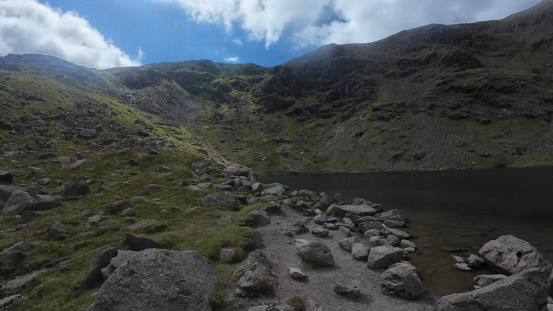
Low Water: A Tarn Formed by Glaciers.
After leaving the quarry, I reached Low Water, a small tarn beneath the summit of the Old Man. Low Water is 1,795 feet (547m) above sea level and is around 46 feet (14m) deep. This tarn was formed by a glacier thousands of years ago and is one of the deeper tarns in the Lake District. On the day I visited, it was really busy and had kids playing in the water, but what was really impressive was the reflection of the cliffs in the water, it really did look amazing.
Reaching the Summit of the Old Man of Coniston.
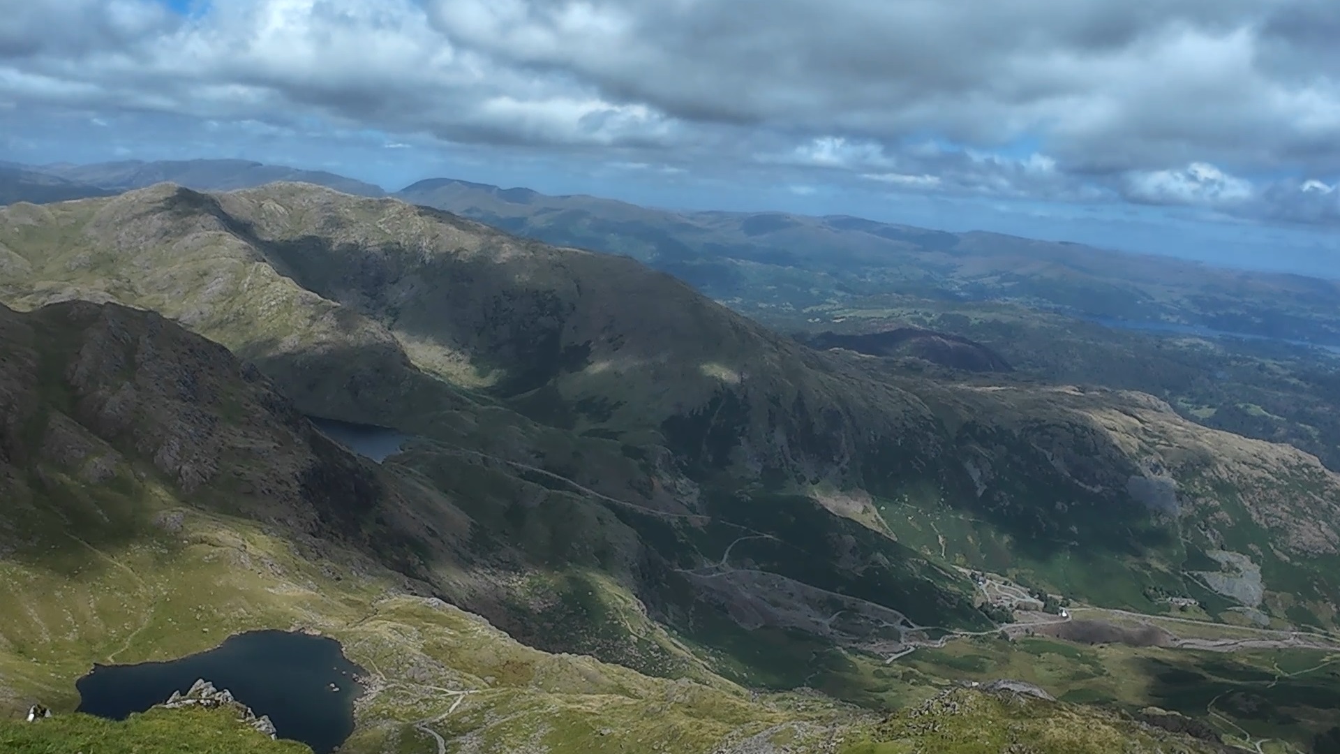
The final climb to the summit of the Old Man of Coniston is steep but has amazing views of the surrounding area. The path is steep and takes you over rocky ground. But when the summit came into view and I looked around, it was worth it. From the summit, you can see far across Coniston Water, the surrounding fells and had breathtaking views and I could see out to Morecambe Bay.
As renowned fell-walker Alfred Wainwright once wrote the Old Man is “a mountain beloved by visitors, respected by climbers, and interesting to industrial historians.” His words say it all.
Heading down via Crag O’Stile, Limestone Haws, and Walna Scar Road
Heading down I took a different route and went down via Crag O’Stile and Limestone Haws, this route still had amazing views as I headed towards Walns Scar Road an old packhorse route that has been in use for centuries. The road from here back to Coniston is quite steep and I passed a young lad in his car that could not make the climb.
Conclusion.
I've been hiking in the Lake District since I was about 16, and this route has been one of my favourites due to the views you get on the way up and at the summit. Whatever your level of experience, the Old Man of Coniston has something for everyone. I’ve seen over the years how the different seasons can completely change the hike, from snow on the summits during the winter to everything in full bloom during spring and summer.