
High Street Lake District 2,717 feet (828m) A Walk to Remember.
On the 9th Sept 2024, I hiked up to High Street in the English Lake District national park, a mountain that stands proudly at 2,717 feet (828m). This hike has amazing views, and history and is a must-do for those who enjoy the outdoors. I started at Haweswater Reservoir and my route took me via Swine Crag, Heron Crag, Eagle Crag, Rough Crag, Caspel Gate and Riggindale Crag.
My Journey starts at Haweswater Reservoir.
My hike begins at Haweswater Reservoir, the reservoir was built in the 1930s to provide water for Manchester when the valley was flooded the then-village of Mardale Green disappeared under the water. Parking at the end of the reservoir near Mardale Head, I followed the path towards 'The Rigg', a forested ridge at the tip of the reservoir.
This part of my hike was pretty easy, as it was along the side of the reservoir and the views of the mountains and the water looked amazing.
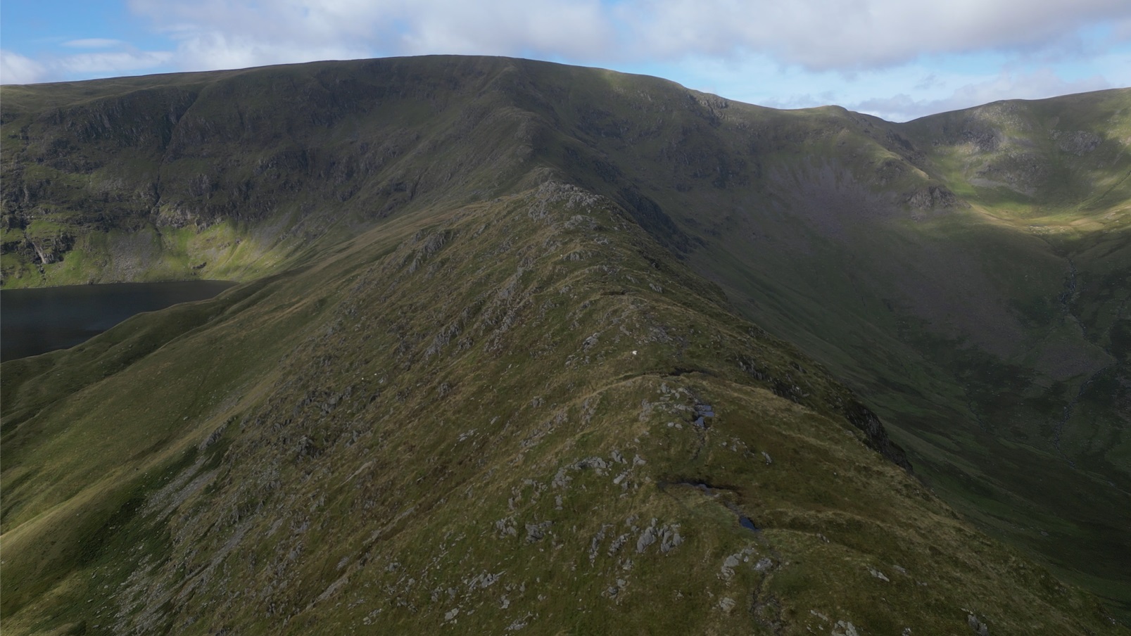
Swine Crag, Heron Crag, and Eagle Crag.
The next stage of my hike took me on a steep incline towards Swine Crag. This was quite a climb and it certainly had my lungs working. Swine Crag offers great views of Hawewater and gives me my first real sense of height and a preview of the amazing views yet to come.
Continuing upwards, the path took me past Heron Crag and Eagle Crag. From here the ground levelled off a bit and provided amazing views of the valley below, you can now see the ridgeline ahead of you from here, and the landscape starts to feel more isolated and rugged.
Rough Crag, Caspel Gate, and Riggindale Crag.
As I continued along the ridge, the path reached Rough Crag and I had to wind my way through the rocks. This section of the hike offers some amazing views of Haweswater behind and Blea Water ahead.
After Rough Crag, I reached Caspel Gate, a shallow saddle between Rough Crag and Riggindale Crag. Caspel Gate was a nice relief from the crags I just passed, but from here I got a better view of Riggindale Crag and the climb up to High Street. The route up Riggindale Crag is more demanding, with the ground becoming rockier and the climb steeper.
The Deep Waters of Blea Water.
As I walked along the ridge towards Riggindale Crag, I passed Blea Water on my left. Situated beneath High Street (Racecourse Hill), Blea Water is the deepest tarn in the Lake District, with a depth of about 207 feet (63m). Blea Water was created by a glacier thousands of years ago, and on the day I visited, the water looked rather dark, giving the impression that the water would be very cold. Blea Water is surrounded by steep cliffs on three sides, and I stopped here for a sandwich and a timelapse video of the clouds moving overhead.
Reaching the Summit: High Street Lake District.
After about three hours, I reached High Street which stands at 2,717 feet (828 m) high. On clear days, you can see as far as the Pennines and even the coast, while closer mountains such as Helvellyn and Scafell Pike can be seen.
High Street is named after the Roman road that once ran across the top of the fell, as it was safer for the Romans to cross the top of the fells than in the valleys in case of ambush and connected the forts at Ambleside and Penrith.
It's also sometimes known as Racecourse Hill because of the 19th-century practice of conducting sports days at the summit which included horse racing.
The Descent: Mardale Ill Bell and Nan Bield Pass.
From High Street, I headed down towards Mardale Ill Bell. At 2,496 feet (761m), it's not as high as High Street but does offer amazing views of Beal Water and Haweswater. From here, the path winds down towards Nan Bield Pass, a popular crossroads that connects Mardale to Kentmere.
Nan Bield Pass is well-marked as it heads down towards Small Water, but it does have lots of twists and turns.
Small Water: Wainwright’s Shelters and Spiders
Heading down from Nan Bield Pass, I reached Small Water and followed the path along the water's edge Small Water also has a series of stone shelters built around its edge. However, in his famous "Pictorial Guide to the Lakeland Fells", Alfred Wainwright famously noted that these shelters were “full of spiders” So be warned if spiders are not your thing. The shelters are basic but do offer protection from the weather if required.
Returning to Haweswater Reservoir.
From Small Water, the path heads back down the valley towards Haweswater Reservoir. The descent is gradual and I passed a few waterfalls and rapids. This hike took me about 5hrs 15mins, I did have a few stops to take photos and drone footage and it was an amazing day.