
Catstycam: A Hiking Adventure via Glenridding to Red Tarn.
On 5th July 2024, I embarked on a memorable ascent to Catstycams, a strikingly rugged peak in the Lake District known for its distinct pyramid-like shape. Setting off from Glenridding, I followed a route that passed the youth hostel and the old mine workings. The climb was gentle as I headed towards the iconic Helvellyn range. As I reached the summit, a sharp chill settled in, but the panoramic views over Red Tarn and the surrounding peaks made every effort worthwhile.
Starting Point: Glenridding.
My hike began in the village of Glenridding, located on the shores of Ullswater. Glenridding is a popular starting point for many Lake District hikes and serves as the gateway to some of the most scenic routes in the area.
Following Glenridding Beck.
From Glenridding, follow the course of Glenridding Beck. This picturesque stream meanders through the valley, providing a tranquil backdrop as you start your ascent. The trail is well-marked and relatively gentle at this stage, making it an ideal warm-up for the more challenging sections ahead. The sound of the beck's flowing water, combined with the fresh, crisp air, sets a serene tone for the hike.
Passing the Old Disused Mine.
As you continue along the path, you'll come across the remnants of the old disused Greenside Mine. This historical site offers a glimpse into the area's industrial past. The Greenside Mine was once one of the most productive lead mines in the Lake District, operating from the 18th century until its closure in the mid-20th century. Today, the mine buildings stand as a testament to the hard work and ingenuity of the miners who once toiled here. Take a moment to imagine what life must have been like for those who worked in this remote and rugged landscape.
Ascending Towards Red Tarn.
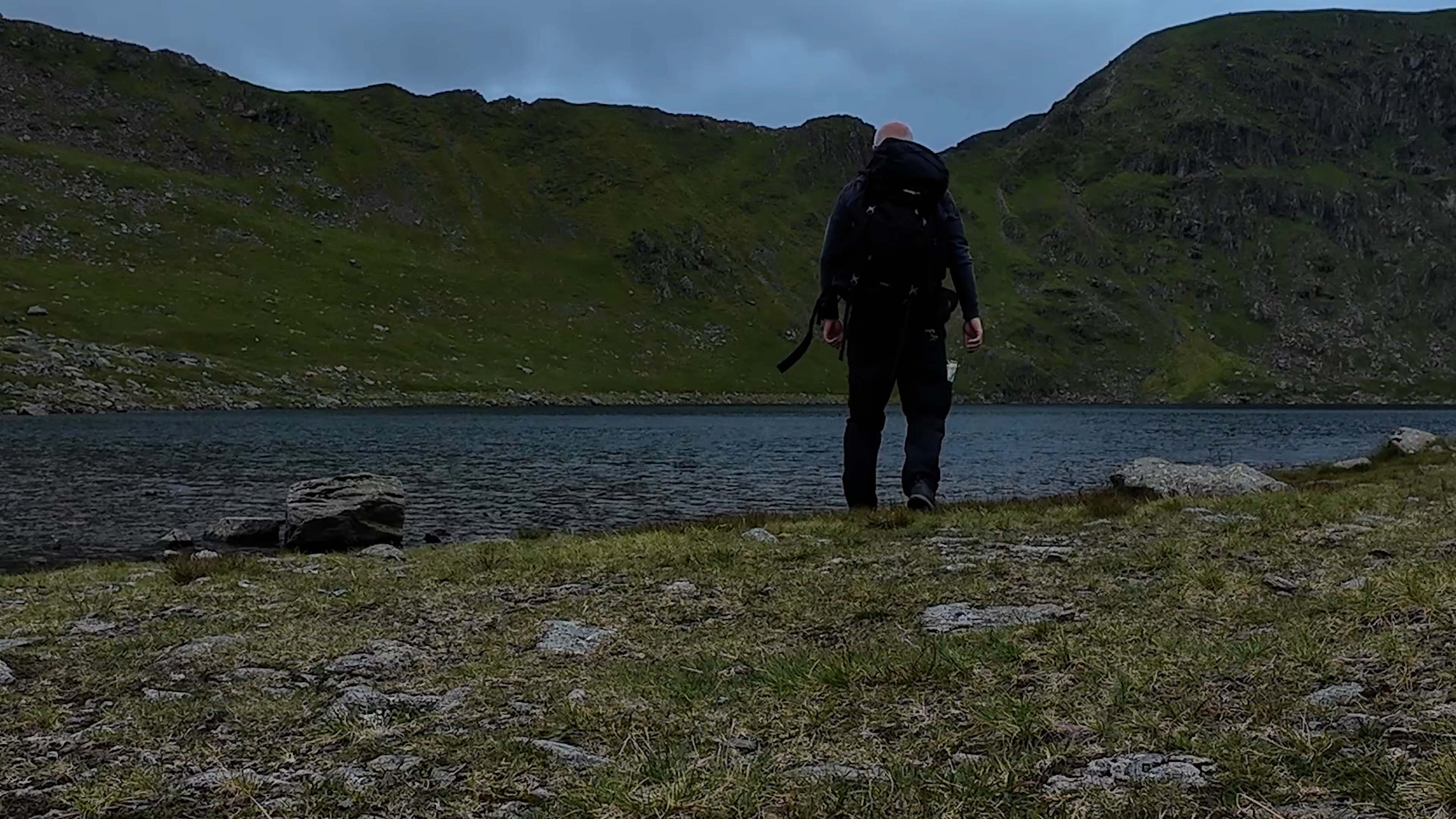
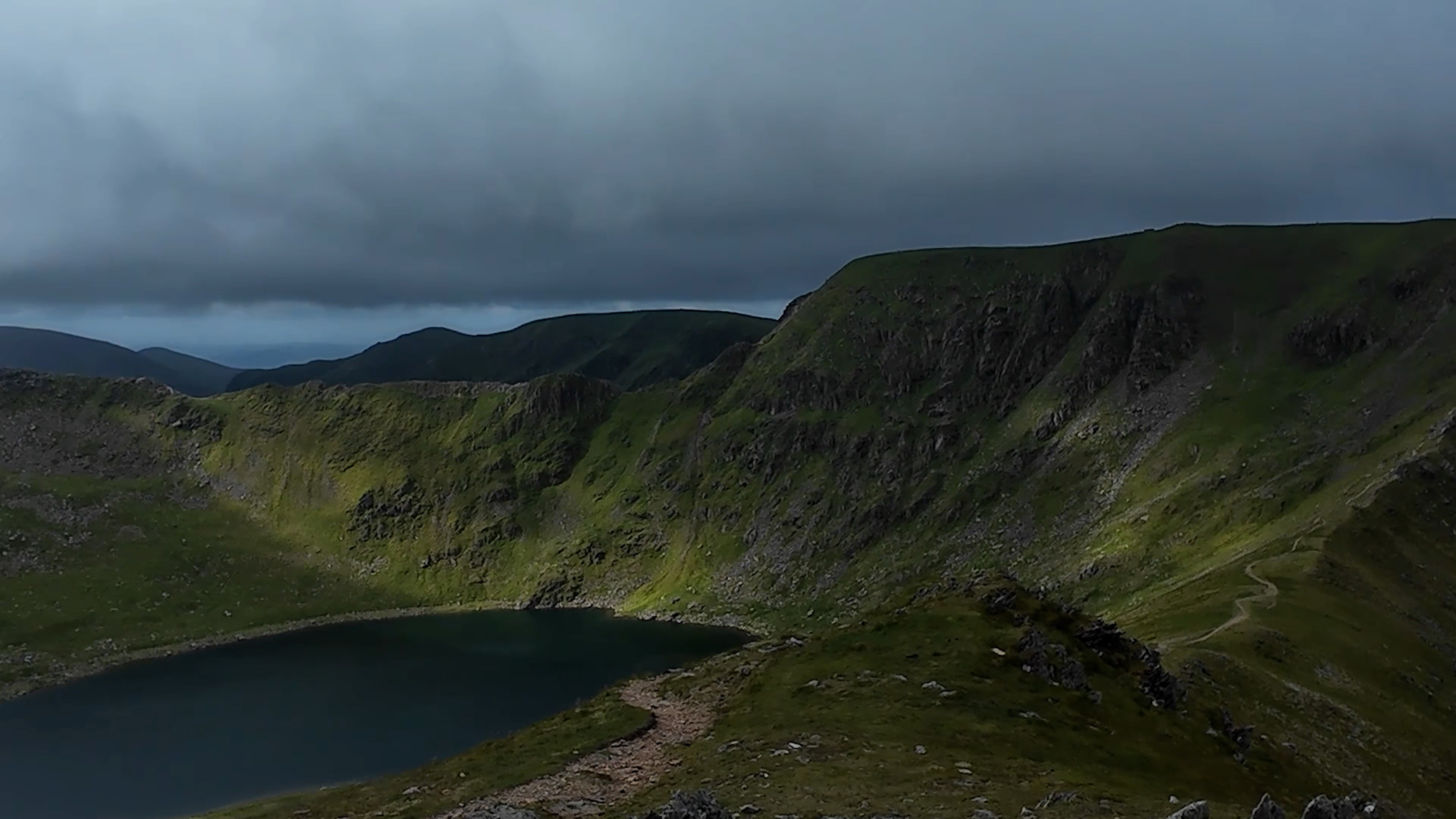
Leaving the mine behind, the path begins to steepen as you make your way towards Red Tarn. Red Tarn is nestled below Helvellyn and Catstycams and is a striking glacial tarn with a depth of approximately 82 feet (25 metres). Formed by glacial activity, this tarn adds to the dramatic landscape, and from Catstycams, the view of Red Tarn, framed by the steep ridges of Helvellyn, is nothing short of breathtaking.
Reaching Catstycam Summit.
From Red Tarn, the final ascent to Catstycam's summit begins. The path becomes steeper and more rugged. Upon reaching the summit, I was rewarded with one of the most breathtaking panoramic views in the Lake District. At 2,920 feet (890 metres), Catstycam is not the highest peak in the area, but its isolated position and distinctive shape make it a standout feature of the landscape.
From the summit of Catstycam, the views are simply awe-inspiring. To the west, you'll see the mighty Helvellyn, one of England's highest mountains, standing at 3,117 ft (950 metres). The sight of Helvellyn's imposing ridges, Swirral Edge and Striding Edge, is particularly striking. These narrow, craggy ridges are famous among hikers and mountaineers for their challenging yet exhilarating routes.
Swirral Edge, which leads from the summit of Catstycam towards Helvellyn, offers a thrilling scramble with steep drops on either side. It's a route that demands caution and respect but rewards those who undertake it with unparalleled views and a sense of accomplishment. Striding Edge, on the other hand, is a narrow ridge that requires careful navigation and a head for heights. It’s one of the most famous scrambles in the Lake District and provides a direct route to Helvellyn’s summit.
Looking to the east from Catstycam, you'll see the verdant valley of Glenridding and the shimmering expanse of Ullswater beyond. The contrast between the rugged peaks and the tranquil lake is a sight to behold. On a clear day, the views extend for miles, encompassing the surrounding fells and valleys in a stunning tableau of natural beauty.
The formation of Catstycam, like many of the Lake District fells, dates back to volcanic activity around 450 million years ago. Over millennia, the forces of erosion sculpted the land into its present form. Glacial movements during the last Ice Age had a profound impact, carving out steep valleys and leaving behind tarns such as Red Tarn. This geological history has resulted in the steep, rugged slopes and dramatic shape that characterize Catstycams today.
On OS maps, Catstycam is spelt Catstye Cam